
Cockfosters
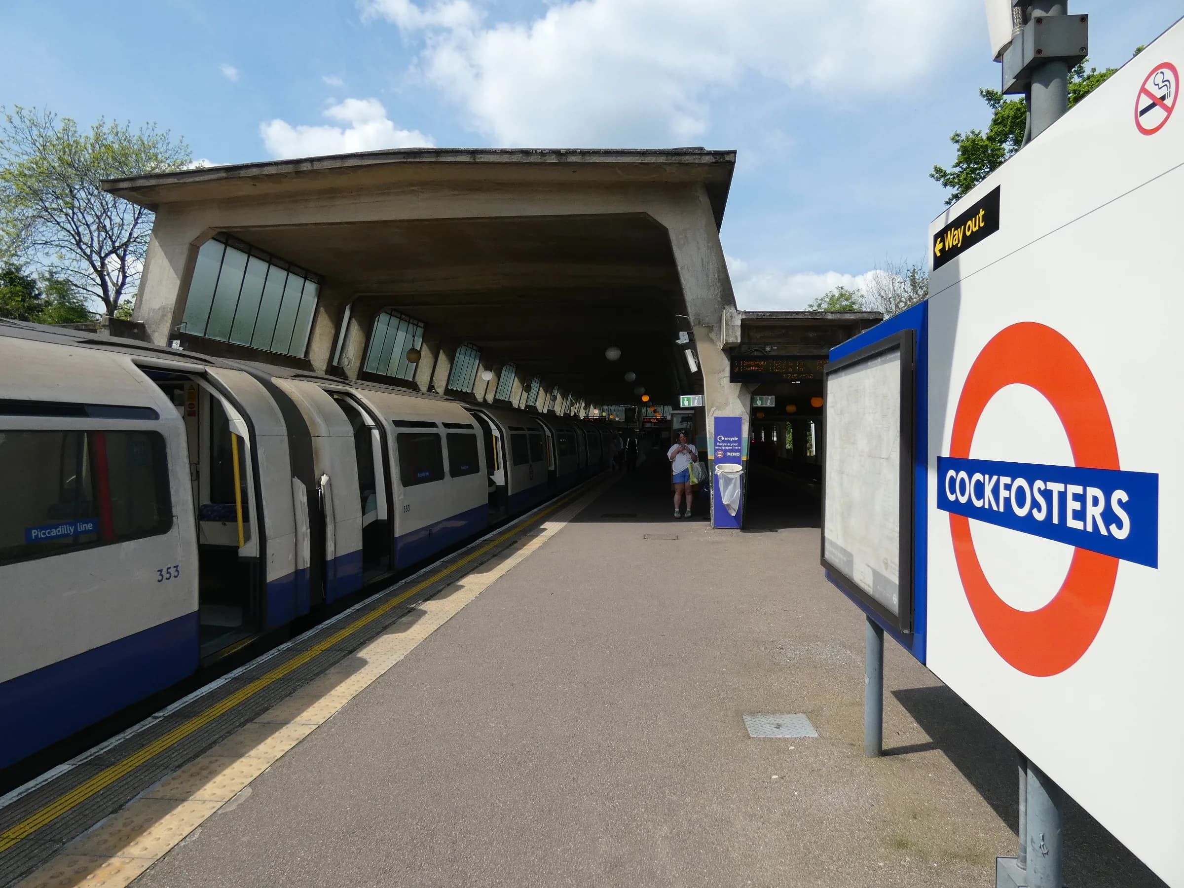
Cockfosters is a suburb in the north-west of the London Borough of Enfield, at the terminus of the Piccadilly line and beside the 400-acre Trent Country Park.
Area guide
Living in Cockfosters
Cockfosters is in the north-west corner of the London Borough of Enfield, close to the boundary with the London Borough of Barnet. Enfield Council is the local authority for the area, although the EN4 postcode district also reaches addresses in Barnet and Hertsmere. Until the early 20th century Cockfosters was a scattering of farms along Chalk Lane. The Piccadilly line reached it in 1933, and by 1935 the council's heritage appraisal describes it as no longer a rural outpost. Cockfosters Underground station, the line's terminus, was designed by Charles Holden and is Grade II listed.
To the north-east lies Trent Country Park, a Grade II registered landscape that began as part of the royal hunting ground of Enfield Chase and has been open to the public since 1973. The park and the green belt around it contrast with the suburbs of Cockfosters and Oakwood, which the council's appraisal describes as the northern fringe of Greater London. Enfield's characterisation study singles out Oakwood and Cockfosters for particularly good examples of inter-war suburban housing, typically semi-detached houses with hipped roofs and bay windows, and cites Cockfosters Road for ribbon development of larger houses on generous plots. It describes the centre around the station as having a wide boulevard layout, with access roads running alongside the main carriageway.
Cockfosters station is in Zone 5. From here the Piccadilly line runs through Oakwood and Southgate, Wood Green and King's Cross St Pancras to central London, and continues to Heathrow and Uxbridge. Postcodes in the area are EN4 and N14.
Transport
Getting around Cockfosters
Cockfosters Underground station (Piccadilly line terminus, Zone 5) serves the area. Trent Country Park has entrances on Cockfosters Road and Hadley Road.
Cockfosters
Piccadilly · Zone 5
Terminus of the Piccadilly line; Grade II listed 1933 station designed by Charles Holden.
Parks, shops and schools
What Cockfosters has nearby
Parks and green space
- Trent Country Park (opens in a new tab)Grade II registered park of around 400 acres of meadow, woodland and lakes on Cockfosters Road, formerly part of Enfield Chase.
Schools
Cockfosters is in the London Borough of Enfield, which is the local education authority for its state schools. Use the official tools below to check individual schools' inspection reports, published performance data and admission arrangements.
A little history
Trent Park began as part of the royal hunting ground of Enfield Chase, which was divided and enclosed after an Act of 1777, and the estate later passed through the Bevan and Sassoon families before opening to the public as Trent Country Park in 1973. The arrival of the Piccadilly line in 1933 turned the hamlet of Cockfosters into a suburb.
Local favourites
Worth knowing in Cockfosters
Roads and pockets
- Cockfosters Road — the main road past the station and along the western edge of Trent Country Park; Enfield's characterisation study cites it for ribbon development of large houses on generous plots.
- Chalk Lane — the historic lane along which the farms of the original Cockfosters hamlet were scattered; the Grade II listed war memorial stands at its junction with Cockfosters Road.
- Hadley Road — has an entrance to Trent Country Park, and the conservation-area appraisal notes views of rolling countryside from Ferny Hill and Hadley Roads.
- Bramley Road — runs along the southern edge of the Trent Park Conservation Area, where a fringe of trees and hedging screens the parkland from the suburb of Oakwood.
Places worth a visit
- Trent Country Park — Grade II registered park and garden, formerly part of the royal hunting ground of Enfield Chase, with around 400 acres of meadow, woodland and lakes, open to the public since 1973.
- Camlet Moat — a scheduled medieval moated site inside Trent Country Park, the traditional site of a manor house or hunting lodge in Enfield Chase (Historic England list entry 1005551).
- Cockfosters Underground Station — Grade II listed Piccadilly line terminus of 1933 by Charles Holden, with a prow-shaped booking hall and a concrete-framed train shed.
- Cockfosters War Memorial — Grade II listed stone wheel-head cross at the junction of Chalk Lane and Cockfosters Road, unveiled in March 1921.
Compiled from public sources such as council guidance and local history records, and reviewed October 2026. These are not recommendations or valuations.
Property market
Property prices in Cockfosters
Median sold price
£657,500
477 sales in the 12 months to July 2026
| Property type | Median | Sales |
|---|---|---|
| Detached | £977,500 | 52 |
| Semi-detached | £767,500 | 184 |
| Terraced | £630,000 | 92 |
| Flats & maisonettes | £365,000 | 149 |
Based on completed sales registered at postcodes in EN4, N14, which only approximate the area's boundaries and include sales we did not handle. Standard (category A) residential sales for value only: the Land Registry’s category B, which includes repossessions, buy-to-lets identified by a mortgage and sales to non-private individuals, is not counted. Contains HM Land Registry data © Crown copyright and database right 2026. This data is licensed under the Open Government Licence v3.0.
Questions
Cockfosters: common questions
Quick answers about living in and moving to Cockfosters.
Is Cockfosters in Barnet or Enfield?
Cockfosters is in the London Borough of Enfield, in the Cockfosters ward, and Enfield Council collects council tax there. The Barnet boundary is close, and the EN4 postcode district also covers addresses in Barnet and Hertsmere, so confirm any individual address with GOV.UK's Find your local council tool.
Which station serves Cockfosters and what zone is it in?
Cockfosters Underground station is the terminus of the Piccadilly line and is in Zone 5. The Grade II listed station building dates from 1933 and was designed by Charles Holden.
Which postcode districts does Cockfosters cover?
Enfield Council's ward profile says the Cockfosters ward is covered by the EN4 and N14 postal districts. EN4 also covers addresses in the London Borough of Barnet and in Hertsmere.
Which parks and green spaces are in Cockfosters?
Trent Country Park on Cockfosters Road is a Grade II registered park of around 400 acres, with meadow, woodland and lakes. It has been open to the public since 1973 and contains Camlet Moat, a scheduled medieval moated site.
How does the Piccadilly line connect Cockfosters to central London?
Cockfosters is the end of the Piccadilly line, so trains start here and call at Oakwood, Southgate, Arnos Grove, Bounds Green, Wood Green, Turnpike Lane, Manor House and Finsbury Park before King's Cross St Pancras, Holborn, Covent Garden, Leicester Square and Piccadilly Circus. The line continues to Heathrow and Uxbridge. Check TfL's journey planner for current timings.
Location
Where Cockfosters is
Nearby
Nearby areas
Value my property
Selling or letting in Cockfosters?
Talk to our local team about the market in Cockfosters — book a free, no-obligation valuation or call the office.